
Overview

Best Time
May–June / September

Duration
3 – 7 Days

Terrain
Road / Gravel

Difficulty
Beginner to Advanced

Challenges
Wind

Best Bike
Gravel / Touring Bike
Guide Contents
- Overview
- When to Go
- Bike & Packing Recommendations
- Getting To/From The Peninsula
- Weather
- Camping & Accommodation
- Food & Resupply
- Water
- Bikepacking Routes on Kintyre
- Cycle Shops & Repairs
- Cycling Clubs on Kintyre
- Bikepacking Highlights on Kintyre
- Bikepacking Kintyre on a Budget
- Safety
- Midges, Wildlife & Ticks
This Kintyre bikepacking guide explores a peninsula that feels very different to much of mainland Scotland. Long, narrow and stretching deep into the Atlantic, Kintyre offers quiet coastal roads, empty glens, remote beaches and a strong sense of isolation that’s becoming increasingly hard to find elsewhere in the UK.
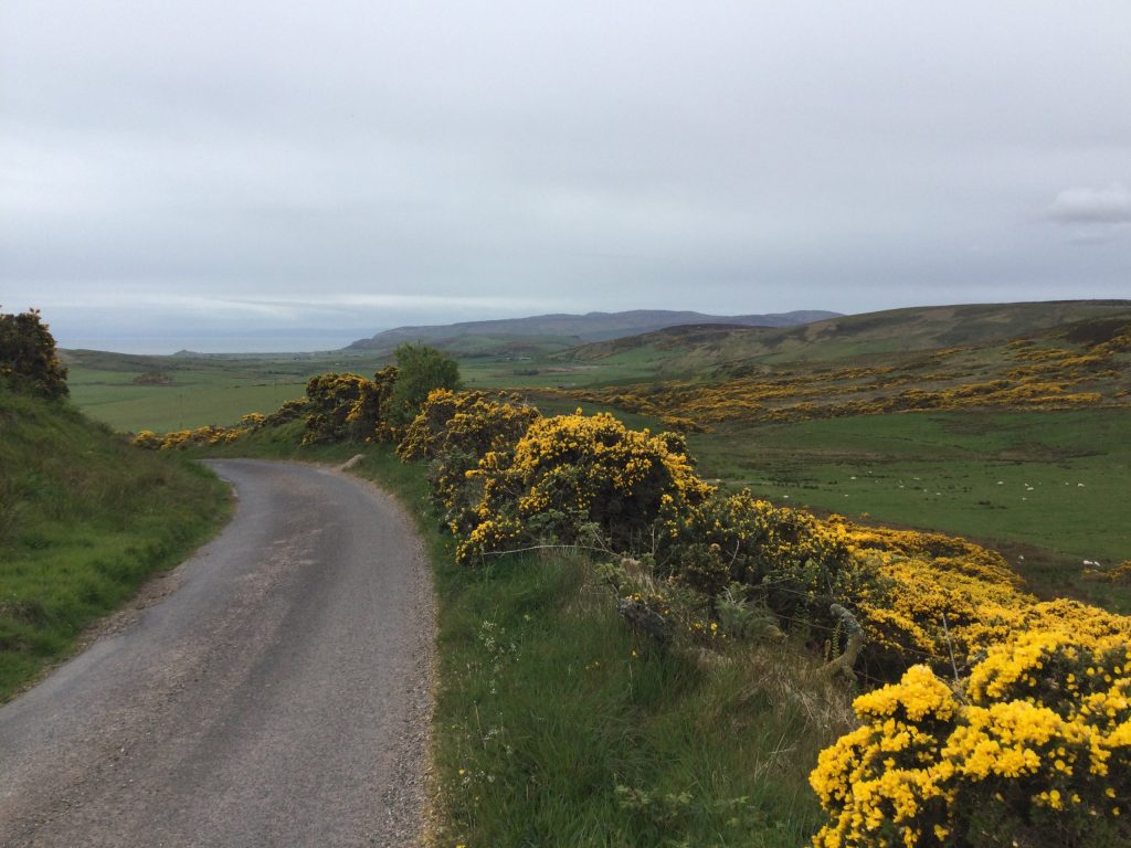
It’s a place that rewards taking your time. Distances can look short on a map, but the constant rolling terrain, changing weather and endless photo stops quickly slow progress in the best possible way. One moment you’re riding exposed coastline with views towards Islay, Jura and Arran, the next you’re climbing through forestry tracks or descending into tiny fishing villages that can feel almost untouched by time.
Unlike Arran, Kintyre doesn’t immediately impress with dramatic mountain scenery. Its landscapes reveal themselves more gradually. The rewards here come from quietness, remoteness and atmosphere rather than towering peaks. Expect deserted beaches, hidden coves, sea cliffs, peat moorland, forestry tracks and some of the quietest roads you’ll find on mainland Scotland.
The North
Northern Kintyre around Claonaig, Skipness and Tarbert feels greener and more sheltered. Ancient woodland, sea lochs and steep coastal hills dominate the landscape, while views towards Arran are almost constant along the east coast.
In poor weather, parts of this area can feel surprisingly Highland-like. You’ll also find some of Kintyre’s most interesting historic sites here, along with old fishing settlements and quiet roads that lend themselves perfectly to loaded touring.

The South
The further south you travel towards Campbeltown and the Mull of Kintyre, the more exposed and remote the peninsula begins to feel. The roads narrow, settlements thin out and Atlantic weather starts shaping the whole experience.
The south has a much rawer, windswept character, with huge beaches, rugged cliffs, open moorland and long empty stretches of coastline. On a calm sunny day it can feel surprisingly gentle. When the weather turns, it feels properly wild.
Kintyre is one of those places that can easily be overlooked in favour of Scotland’s better-known cycling destinations, but that’s part of what makes it so appealing. Whether you’re here for quiet coastal roads, remote wild camps or rougher gravel riding inland, this guide aims to give you the practical information you need to plan a bikepacking trip around one of Scotland’s less-visited peninsulas.
About this guide
This guide is built from first-hand experience. Most of it comes directly from notes I made while riding and camping around Kintyre — often late at night in the tent, after experiencing the routes, weather and logistics described below.
Where information didn’t come directly from me, it came from other bikepackers I met on the peninsula or from later first-hand contributions. This isn’t generic destination information copied together from around the web. Where practical details needed updating — such as ferry information, opening times or current services — I’ve checked them against current operator or business information.
Details such as prices, ferry timetables and opening times can change. Everything was accurate to the best of my knowledge when published, but if you spot a mistake, have an update or think something is missing, please get in touch.
Affiliate disclosure: Some links on this page are affiliate links. If you make a booking or purchase through one of them, FTtouring may earn a small commission at no extra cost to you. I only include links where they are relevant and useful to planning the trip.
When to Go
Generally speaking, the best time to go bikepacking in Kintyre is from late April through to early September, with May, June and September offering the best balance of daylight, quieter roads and manageable weather. The peninsula is heavily influenced by Atlantic systems, so wind and rapidly changing conditions can play a big part in any trip.
May and early June would be my preferred time to visit, before the main summer rush and while midge numbers are generally lower. September is another strong option, with quieter roads, cooler evenings and often excellent coastal light.
Summer brings the warmest temperatures and longest days, but also busier campsites and more midges. Winter riding is possible, but the combination of short daylight, persistent rain and strong winds makes it much more demanding.
Bike & Packing Recommendations
I rode Kintyre on my Kona Unit X with 29-inch wheels and 2.6-inch tyres. Off-road, the setup worked brilliantly. The wider tyres gave me plenty of grip and comfort on forestry tracks, rough gravel and the more broken-up sections of trail.
The trade-off was on the road. At 2.6 inches wide, the tyres were noticeably slower on tarmac than a narrower gravel or touring setup would have been, particularly on longer road sections. If I was building a bike specifically for Kintyre, I’d still want something capable off-road, but I’d probably lean towards slightly narrower tyres for a better balance between speed on the road and control on the gravel.
A gravel or touring bike is therefore probably the best all-round choice for most riders. You don’t need a particularly technical mountain-bike setup, but something reliable, comfortable when fully loaded and happy across a mix of tarmac, gravel and rougher track will make the trip much easier.
Kintyre’s Atlantic exposure also means your packing choices matter. Good waterproofs are essential in every season, and fast-drying clothing makes life much easier when you get caught in repeated showers. A wind-resistant tent or shelter is worth carrying too, especially if you’re planning to wild camp along the more exposed west and south coasts.
Recommended for Kintyre:
- Waterproof jacket and trousers
- Warm insulated layer
- Fast-drying riding clothes
- Midge repellent or head net
- Tick remover
- Tool kit and spare tubes
- Water filter
- Reliable GPS/GPX navigation
- Wind-resistant tent or shelter
Getting To/From The Peninsula
Kintyre feels remote, but it’s surprisingly well connected by road, bus and ferry. Tarbert at the northern end of the peninsula is the main gateway from mainland Scotland, while Campbeltown provides the biggest transport hub further south.
For bikepackers, the ferry connections are particularly useful because they make it easy to combine Kintyre with Arran, Cowal and the wider west coast without having to retrace your route.
From Mainland Scotland:
By Road
From central Scotland, the main road route reaches Tarbert via the A82 and A83, passing Loch Lomond, Arrochar, Inveraray and Lochgilphead before continuing south onto the peninsula.
For cyclists, this is a scenic approach but also a fairly substantial ride in its own right. Anyone arriving by car should remember that many good bikepacking routes through Kintyre are point-to-point, so it’s worth thinking about how you’ll return to the vehicle before leaving it behind.

By Bus
The main public-transport connection is the Citylink / West Coast Motors 926 service between Glasgow and Campbeltown, which stops in Tarbert on the way.
There are several services each day, but riders travelling with a fully loaded bicycle should check ahead before relying on it. The buses don’t have dedicated bike racks, and bicycle carriage depends on available luggage space and the driver’s discretion.
By Ferry
Ferry travel is one of the easiest and most enjoyable ways to reach Kintyre with a bike.
Portavadie → Tarbert
The Portavadie ferry arrives directly into Tarbert at the northern end of Kintyre. The CalMac service operates year-round under seasonal timetables and is run on a Turn Up and Go basis. Pedal cycles are carried free in addition to the passenger fare. For the latest timetable and prices, visit the booking page on CalMac’s website here
Lochranza → Claonaig
If arriving from Arran, the short ferry from Lochranza to Claonaig is another excellent option. I used this route myself, buying my ticket onboard before the roughly 30-minute crossing. From Claonaig it’s around 10 miles by road to Tarbert, although you can just as easily start exploring Kintyre immediately rather than heading north first.
The service operates under summer and winter timetables and bicycles are carried free alongside the passenger fare. Groups of cyclists should check current CalMac guidance before travelling.
By Train
There is no railway station on Kintyre.
The most practical rail option is therefore to travel to Glasgow and continue by bus, bike or a ferry-linked route. Another option is to take the train towards the Clyde coast and approach through Arran, although this adds considerably more riding.
By Air
Campbeltown Airport is the nearest airport and sits close to Machrihanish.
Geographically it’s convenient for South Kintyre, but for most bikepackers travelling with a bicycle, Glasgow is likely to be the more useful transport hub because it offers far more onward connections and several practical ways of reaching the peninsula.
Back to the mainland
Leaving Kintyre with a bike is fairly straightforward, although the best option will depend on where you finish your ride. If you end around Tarbert, you can simply continue north by road towards Lochgilphead and the rest of mainland Scotland, or take the ferry from Tarbert across to Portavadie if you want to continue exploring Cowal and the wider west coast.
If you finish further south, Campbeltown is the main transport hub. The 926 bus runs north through Tarbert towards Glasgow, although travelling with a fully loaded bicycle can be difficult because the buses don’t have dedicated bike racks and carriage depends on available luggage space and the driver’s discretion.
For me, the ferries are the most useful option when travelling with a bike. They allow you to turn Kintyre into part of a much longer west-coast journey rather than simply retracing the route you used to get there.
Onwards to the Islands
If you’re looking to carry on island hopping, then you have multiple options from Kintyre, including the Isle of Arran (see the guide here), Isle of Islay or Isle of Gigha. These options work particularly well if you’re incorporating Kintyre into a longer island-hopping trip rather than treating the peninsula as a standalone destination.
Onwards to Arran
You cycle to Claonaig, on the east side of the Kintyre Peninsula, then take the CalMac ferry across Kilbrannan Sound to Lochranza in northern Arran. Bikes are carried, so for a bikepacking trip it’s a very natural connection between the two.
The crossing itself is short — roughly 30 minutes — and once you arrive at Lochranza you’re directly on Arran’s road network, so you can immediately continue south around the island. Check Arran ferry times & prices
Onwards to Gigha
The Isle of Gigha is an easy addition to a Kintyre bikepacking trip. Ferries leave from Tayinloan, on Kintyre’s west coast, and cross to Ardminish on Gigha. The crossing takes around 20 minutes and bicycles are carried, making it a straightforward option for riders wanting to extend their trip onto the island. From Ardminish, Gigha is small enough to explore easily by bike before returning to Kintyre or continuing your journey. Book with CalMac here
Onwards to Cowal
From Tarbert, you can take the ferry across Loch Fyne to Portavadie on the Cowal Peninsula. It’s a short crossing and bicycles are carried, making it an easy way to continue a bikepacking journey without having to ride north around Loch Fyne. Once at Portavadie, you can continue exploring Cowal by bike, with quiet roads and further ferry connections opening up several options for travelling onwards through western Scotland. Book with CalMac here
Onwards to Islay
If you want to continue from Kintyre to Islay, the most useful connection is from Kennacraig, just south of Tarbert. CalMac ferries sail from Kennacraig across to Islay, arriving at either Port Ellen or Port Askaig, depending on the service. Bicycles are carried, making this a straightforward way to add Islay to a longer bikepacking trip through Kintyre and the surrounding islands.
Kennacraig is easily reached by bike from Tarbert, so it works particularly well if you finish your Kintyre ride towards the northern end of the peninsula. Once on Islay, you can continue directly by bike, with both ferry terminals connected to the island’s road network. As routes and timetables vary seasonally, check the current CalMac schedule before deciding which Islay port works best for your onward journey. Tickets can be booked via Directferries on their website here
Weather
Kintyre’s weather is heavily influenced by the Atlantic, and conditions can change surprisingly quickly. Even during the warmer months, a calm morning can turn into strong wind and rain later in the day, so it’s worth treating the forecast as a guide rather than something your plans depend on completely.
For me, wind is the biggest weather factor to consider when riding Kintyre. Much of the peninsula is exposed, particularly along the west coast and further south towards Campbeltown and the Mull of Kintyre. A strong headwind can turn an otherwise straightforward day into a slow one very quickly.
Rain is another constant possibility. Showers can arrive and disappear quickly, but longer Atlantic systems can also settle over the peninsula. Good waterproofs are worth carrying regardless of the season, particularly if you’re camping and have nowhere indoors to dry everything overnight.
The upside of Kintyre’s exposed position is that the weather can change just as quickly in your favour. Grey skies can clear, visibility can suddenly open across the sea towards Arran, Islay or Jura, and a difficult wet morning can become a completely different ride by the afternoon.
Wind
Wind deserves particular attention when planning daily distances. The more exposed west and south coasts can be significantly harder in poor conditions, while forestry and some of the eastern side of the peninsula can provide more shelter.
I wouldn’t plan the entire trip around an assumed prevailing wind direction. Check the forecast each day and be prepared to shorten or alter a route if conditions become uncomfortable. On Kintyre, flexibility is often more useful than trying to stick rigidly to a planned mileage.
Seasonal Breakdown
Spring (March → May)
Spring is arguably one of the best times to go bikepacking in Kintyre. The peninsula begins drying out after winter, daylight increases quickly and the roads remain relatively quiet. Conditions are still cool, particularly in March and early April, but the combination of longer days and increasingly settled weather makes riding much more comfortable.
By May the landscape has turned noticeably greener, campsites and seasonal businesses are opening again and midge numbers are generally still low. Westerly winds and rain showers remain part of the experience, so proper waterproofs and a warm sleeping setup are still worth carrying, especially earlier in the season.
Typical daytime temperatures:
March: 6–10°C
April: 8–12°C
May: 10–16°C
Summer (June → August)
Summer brings Kintyre’s warmest temperatures and longest days, with enough daylight around midsummer to make long riding days possible without feeling rushed. Gravel and forestry tracks are generally at their driest, ferry services and seasonal businesses are operating fully and warmer conditions make beach stops and swimming considerably more appealing.
The downside is that summer also brings more visitors and much higher midge activity, particularly during calm, damp evenings around woodland and sheltered areas. Atlantic weather doesn’t disappear just because it’s summer either, and periods of heavy rain, strong winds, sea mist and rapidly changing conditions can still arrive with little warning.
Typical daytime temperatures:
June: 14-20°C
July: 14–20°C
August: 14–20°C
Autumn (September → November)
Early autumn is one of Kintyre’s most underrated bikepacking periods. September can still bring mild temperatures and settled weather while the roads and campsites become noticeably quieter after summer. Midge activity begins dropping with the first colder nights and the softer autumn light can make the exposed coastline particularly impressive.
As the season progresses, conditions become much less predictable. Rainfall increases, Atlantic storms become more frequent and daylight disappears quickly. Gravel tracks can become muddy or waterlogged after prolonged rain, while strong headwinds on the exposed western and southern coasts can reduce daily distances considerably.
Typical daytime temperatures:
September: 12–17°C
October: 9–13°C
November: 6–10°C
Winter (December → February)
Winter bikepacking in Kintyre is best suited to riders who are comfortable with short daylight, persistent rain and strong Atlantic winds. Temperatures are generally moderated by the sea, so severe cold is less common than further inland, but the combination of dampness, exposure and wind chill can make conditions feel considerably harsher than the thermometer suggests.
The reward is an exceptionally quiet peninsula, with empty roads, dramatic seas and a much stronger sense of isolation. Ferry disruption becomes more likely, camping is considerably less comfortable and daily distances need to remain flexible, but settled winter days can bring excellent visibility and some spectacular coastal riding.
Typical daytime temperatures:
December: 5-9°C
January: 4-8°C
February: 4-9°C
Camping & Accommodation
Kintyre works particularly well for bikepackers who are happy to mix wild camping with the occasional campsite or night indoors. Formal options are a little spread out, but Tarbert, Carradale, Campbeltown and Machrihanish give you the best chance of finding somewhere to stay without having to plan every night in advance.
Hotels/B&Bs/Hostels
Tarbert and Campbeltown offer the widest choice of accommodation, with guest houses, hotels and self-catering options available. Carradale and Machrihanish also have a useful range for their size, while smaller villages tend to have fewer choices and more seasonal availability.
Machrihanish in particular has a surprisingly good selection, including the Ugadale Hotel and Ugadale Cottages. Southend is more limited, with a smaller mix of guest-house, pub and self-catering options. If you’re relying on accommodation rather than camping, booking ahead is sensible during summer and at weekends.

Campsites
Formal campsites are available, but they are relatively limited compared with the size of the peninsula, so it’s worth checking where they are before setting out.
(All information correct as of May 2026)
Carradale
Carradale Bay Caravan Site
Carradale Bay is one of the more useful stops for bikepackers, with tent pitches alongside toilets, showers and Wi-Fi. The site currently lists 22 camping pitches and operates seasonally.
Contact Details:
Address:
Carradale Bay Caravan Site, Carradale, Campbeltown, Argyll & Bute
PA28 6QG
Website:
Phone number:
01583 431665
Machrihanish
Machrihanish Holiday Park
Machrihanish Holiday Park is another practical option further south, with non-electric tent pitches, toilets, heated showers, drinking water, laundry facilities and a small shop.
Contact Details:
Address:
Machrihanish Holiday Park, Machrihanish, Campbeltown, Argyll, Scotland
PA28 6PT
Website:
Phone number:
01586 810366
Wild Camping
Wild camping gives you far more flexibility in Kintyre and is one of the best ways to experience the peninsula. There are plenty of quieter areas around forestry, moorland, rivers and the more remote stretches of coastline where it’s possible to find a discreet place to stop for the night.
The route notes also identify suitable wild-camping terrain around quieter river sections, forestry and the area before Lussa Loch, which gives a good indication of the sort of places that work well away from the busier settlements.
As elsewhere in Scotland, wild camping should be lightweight, responsible and carried out in line with the Scottish Outdoor Access Code. Keep well away from homes and working land, avoid blocking access, leave no trace and move on if a spot clearly isn’t suitable.
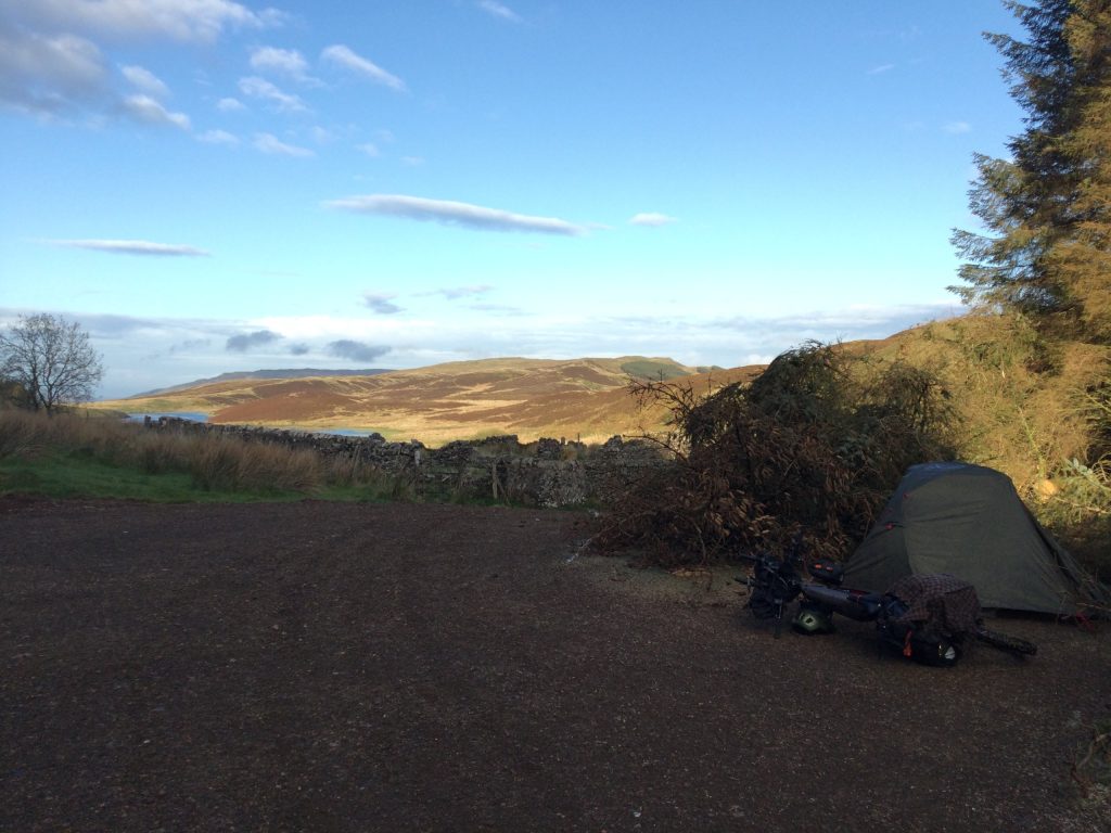
For me, the appeal of camping in Kintyre is the freedom it gives you. You don’t have to force the day to end at a particular campsite or village. If the weather turns, your legs are done or you simply find a great spot, you can stop there and make that the end of the day.
Food & Resupply
Kintyre is reasonably easy to manage for food as long as you don’t leave resupply too late. The main towns and villages are spread far enough apart that you’ll want to think ahead before heading onto longer gravel or forestry sections, but there are enough shops around the peninsula that carrying several days of food usually isn’t necessary.
Campbeltown is the main resupply hub in the south, while Tarbert is the obvious place to stock up before heading further down the peninsula. Between the two, smaller village shops provide useful opportunities to top up, but opening hours can be more limited and shouldn’t always be relied upon late in the day.
Tarbert
Tarbert is one of the best places to stock up, particularly if you’re beginning a trip from the north of the peninsula.
There is a Co-op as well as a Londis, giving you a good choice for a full food resupply before heading south. You’ll also find bakeries, cafés and ATM points.
Skipness
Skipness has a small shop and can be useful for topping up supplies while riding the eastern side of the peninsula. I’d treat it more as a useful stop for basics rather than somewhere to rely on for a major resupply.
Clachan
Clachan has a petrol station with a shop, which makes it another useful stop for snacks, drinks and basic supplies while travelling through the northern part of Kintyre. It’s also home to a cyclist’s favourite: £1 pick-n-mix bags.
Carradale
Carradale has a community shop and is one of the more useful resupply points on the east coast.
Campbeltown
Campbeltown is the biggest resupply point on the peninsula and the place where you’ll find the widest range of food and other supplies with stores such as Tesco and Co-op available. The town also has plenty of bakeries and cafés.
If you’re heading further south towards Machrihanish, Southend or the Mull of Kintyre, this is the place to stock up properly rather than assuming you’ll find a full grocery shop later.
Smaller Settlements
Smaller villages can have cafés, honesty boxes and occasional local shops, but I wouldn’t build a food plan around these alone.
Top Tip – On a budget? Pop into a Co-op late in the day for the best chance to grab some reduced bargains. Sundays are especially good.
Eating Out
Eating out is easiest in Campbeltown and Tarbert, where you’ll find the widest choice of cafés, pubs, restaurants and takeaway food. Smaller places such as Carradale, Tayinloan and Southend also have options, although choice becomes much more limited and opening hours can be seasonal.
For a bikepacking trip, I wouldn’t rely on finding somewhere to eat every evening, particularly once you head into the quieter parts of the peninsula. If you’re planning to wild camp or ride some of the more remote gravel sections, it’s worth carrying enough food for at least one meal rather than assuming there’ll be a pub, café or takeaway waiting at the end of the day.
Water
Water is generally manageable around Kintyre, but I wouldn’t assume you’ll find a public tap whenever you need one. Once you leave the larger settlements and head onto the longer forestry, moorland and gravel sections, reliable drinking-water points become much less frequent, so it’s worth filling up whenever you get the opportunity.
Shops and cafés — Bottled water is available from shops around the peninsula, with Tarbert and Campbeltown providing the easiest opportunities for a proper refill or to buy larger bottles.
Smaller village shops and cafés can also be useful, and it’s always worth asking if somewhere will refill a reusable bottle rather than automatically buying more bottled water.
Public refill points — There are several useful confirmed places to refill along Kintyre.
Tarbert
A free public water refill point is located outside the Co-op in Tarbert. If you’re heading into the quieter northern or eastern sections of the peninsula, this is a good place to fill everything before leaving town.
Clachan
The filling station at Clachan has a water-filling point and makes a particularly useful stop if you’re travelling down the western side of the peninsula or following the Kintyre Gravel Way south.
Campbeltown
A free public refill point is located on the pier in Campbeltown. This is one of the most useful places to fill up in South Kintyre, particularly before heading towards Southend, Machrihanish or the more remote southern sections.
Taps — You may come across outdoor taps attached to village halls, campsites and other buildings. Unless a tap is clearly marked as a public drinking-water point, I’d always ask permission before using it rather than assuming it’s available to everyone.
Streams and burns — There are plenty of streams and other natural water sources throughout Kintyre, particularly once you head into the hills, forestry and more remote interior. I carry a water filter and would filter or otherwise treat water taken from streams and springs before drinking it. Even when water looks perfectly clean, livestock, wildlife and other contamination further upstream mean appearance alone isn’t a reliable indication that it’s safe.
Bikepacking Routes on Kintyre
Kintyre works particularly well for bikepacking because there isn’t one obvious way to explore the peninsula. Quiet coastal roads can be linked with forestry tracks, gravel and rougher inland sections, making it easy to build a route around the type of riding you enjoy and the amount of time you have available.
The Kintyre Gravel Way is the main bikepacking route through the peninsula, adapted from the walking-focused Kintyre Way to avoid sections that simply aren’t practical with a loaded bike. For riders who prefer to stay predominantly on tarmac, the Kintyre 66 provides a good road-based alternative, while shorter rides around Southend, the Mull of Kintyre and the east coast can easily be incorporated into a longer trip.
The routes below provide a few different ways of experiencing Kintyre, from multi-day journeys to shorter sections that can be linked together as part of your own route.

Kintyre Gravel Way
The Kintyre Gravel Way is the bikepacking adaptation of the Kintyre Way, linking together some of the best rideable sections of the peninsula using quiet roads, forestry tracks and gravel. The original Kintyre Way is designed as a walking route, and several sections are simply unsuitable or unnecessarily difficult with a loaded bike, so this reworked route creates something that makes much more sense on two wheels.
It’s the route I’d choose if you want to experience more than Kintyre’s roads, taking you away from the coast and into the quieter forests, glens and interior of the peninsula while still connecting its villages and resupply points.
I’ve put together a separate Kintyre Gravel Way Route Guide with the complete route, three-day itinerary, GPX files and everything you need to ride it yourself.

Kintyre 66
This is the obvious road-based counterpart. It’s a 66-mile loop using the A83 and B842, with six optional spurs, and it can be ridden as a cycling route rather than just driven. Sections of these roads are busy and better suited to experienced road cyclists.
Southend to Mull of Kintyre
The ride from Southend to the Mull of Kintyre takes you into one of the most remote and exposed corners of the peninsula. From Southend, the route heads west towards the Atlantic before climbing towards the Mull of Kintyre, where the landscape becomes increasingly open and isolated.
The final approach is steep and exposed, but the reward is a real feeling of reaching the end of the land, with huge views out across the sea when the weather cooperates. It works well as an out-and-back ride from Southend or as an addition to a longer bikepacking route through southern Kintyre.
Campbeltown to Southend
The ride from Campbeltown to Southend is a straightforward way to explore the southern end of Kintyre. Leaving Campbeltown, the route follows quiet roads south through increasingly open countryside, with the landscape becoming more remote as you move away from the peninsula’s main town.
Southend makes a natural destination, with its coastline, beaches and views across the surrounding islands and Northern Ireland on a clear day. From here, you can return to Campbeltown or continue west towards the Mull of Kintyre, making this a useful section to incorporate into a longer exploration of southern Kintyre.
Tayinloan to Carradale
The route from Tayinloan to Carradale is one of the better options if you want a shorter taste of Kintyre’s rougher, more remote riding. Rather than following the coastline all the way around, the route crosses inland before eventually dropping back towards the east coast at Carradale.
It’s a good introduction to the quieter interior of the peninsula, combining more isolated riding with the satisfaction of emerging back at the coast. The route is suitable for cycling and works particularly well for riders wanting some off-road adventure without committing to the full Kintyre Gravel Way.
Cycle Shops & Repairs
Bike repair options are fairly limited around Kintyre, particularly once you leave Campbeltown and head into the quieter northern and central parts of the peninsula. If you’re planning to ride the gravel routes, I’d start with the bike in good condition and carry enough basic tools and spares to deal with punctures, loose bolts and other common problems yourself.
Cycle Shops & Repair Services
Campbeltown
Kintyre E-Bike Hire
Address: Workshop 2, Hazelburn Business Park, Milknowe Road, Campbeltown, PA28 6HA
Phone: 07557 344515
Offering servicing, repairs and a small selection of spare parts, making this one of the main options if you run into mechanical trouble in South Kintyre.
Campbeltown
Kintyre Cycling Services
Address: 3 Longrow, Campbeltown, PA28 6ER
Phone: 07939 149706
Kintyre Cycling Services offers servicing, repairs, bike health checks and parts, and gives you a useful second option if the first workshop can’t help.
Public Bike Repair Stations
We don’t currently have any confirmed public self-service bike repair stations on Kintyre.
Given how limited professional repair options are outside Campbeltown, I’d recommend carrying the basic tools and spares needed to deal with common mechanical problems yourself.
Cycling Clubs on Kintyre
Kintyre Wheelers Cycling Club
Kintyre Wheelers Cycling Club is the main established cycling club around Campbeltown and South Kintyre. The club has organised local rides and time-trial events and provides a useful way for visiting riders to connect with the local cycling community.
You can find more information about them here: Kintyre Wheelers Cycling Club
Bikepacking Highlights on Kintyre
Kintyre’s best moments aren’t concentrated in one place. They’re spread across the peninsula — a castle on the coast, a huge Atlantic beach, a remote road towards the Mull, a small whisky town and evenings watching the light disappear over the west coast. These are the five places and experiences I’d make time for.
1. Skipness Castle
Skipness Castle sits on the east coast of Kintyre and is one of the peninsula’s standout historic stops. The setting is the real attraction, with the castle sitting close to the coast and views opening across towards Arran.
It makes an easy stop if you’re riding through northern Kintyre and is the sort of place that adds a bit of variety to a day otherwise spent on quiet roads and gravel tracks.
2. Machrihanish Beach
Machrihanish Beach is one of the most impressive stretches of coastline on the peninsula, with a huge sweep of sand, dunes and Atlantic surf.
It feels properly exposed and wild, especially when the weather is moving in from the west, and it’s a great place to stop for a while rather than simply ride past.
3. Mull of Kintyre
The Mull of Kintyre feels like one of those places you’ve properly travelled to rather than simply arrived at. The further south you go, the quieter and more exposed everything becomes, with rugged coastline, open views and very little around you. It has that genuine edge-of-the-world feel to it that makes it genuinely worth the effort to find.
4. Campbeltown
Campbeltown is the main town in South Kintyre and gives the trip a completely different feel after long stretches of quiet riding. It’s a historic whisky town with a strong maritime character, and it’s also one of the best places on the peninsula to stop, resupply and take a break before heading back out into the more remote sections.
5. West Coast Sunsets
Some of the best moments in Kintyre come at the end of the day. The west coast opens directly onto the Atlantic, and on a clear evening the sunsets can be spectacular. If you’re wild camping, this is one of the best reasons to stay flexible with where you stop — find a good coastal spot, get the tent up and let the evening do the rest.
Bikepacking Kintyre on a Budget
Kintyre can be a very cheap place to bikepack if you’re happy wild camping and cooking most of your own food.
For a basic touring setup, I’d expect a daily spend of around £10–15 to be realistic if you’re mainly buying food from shops and camping for free. Using formal campsites more regularly pushes that closer to £25–40 a day, while staying in hotels, guest houses or self-catering accommodation can easily take the cost above £60 a day.
Wild camping is probably the biggest money-saver here. Kintyre has enough remote coastline, forestry and quieter inland areas that you don’t need to build your route around paid accommodation every night. The Kintyre Gravel Way is particularly well suited to this style of travel, with formal campsites limited enough that carrying your own shelter gives you far more flexibility anyway.
Food costs are also fairly easy to control if you stock up properly in Tarbert or Campbeltown and avoid relying too heavily on cafés and pubs. Ferries are generally inexpensive for cyclists, so even linking Kintyre with Arran or other nearby destinations doesn’t necessarily add much to the overall cost.
Safety
Kintyre is a very safe place to travel by bike, and crime is unlikely to be the thing you spend much time thinking about. The bigger risks are environmental — weather, exposure, remoteness and the fact that help or services can be a long way away once you leave the main settlements.
Wind is probably the biggest factor. The west and south of the peninsula are especially exposed, and strong headwinds or crosswinds can make progress much slower than expected. If the forecast looks particularly bad, shorten the day rather than forcing the mileage.
Mobile signal can also be unreliable in the more remote inland sections, so I’d download offline maps before setting off and make sure your route is available without a data connection. On the Kintyre Gravel Way, several junctions are easy to miss and the cycling route doesn’t always follow the signed walking trail, so keeping the GPX visible is much more useful than relying entirely on waymarkers.
Forestry tracks and gravel sections can change too. Tree felling, forestry operations, weather damage and vegetation can all affect access or trail conditions. Treat a GPX as a guide rather than an instruction and turn back if something no longer looks safe or appropriate.
Services become sparse surprisingly quickly outside Tarbert and Campbeltown, and professional bike repair options are limited through much of the peninsula. Carry enough food and water for the section ahead, along with the tools and basic spares needed to get yourself out of common mechanical problems.
Finally, some of the road descents can be fast, particularly when you’ve been climbing for a while and suddenly hit good tarmac again. With a loaded bike, give yourself a little more braking room than usual and keep an eye out for loose gravel, wet surfaces and sudden changes in weather.
5 Things I Wish I’d Known Before Bikepacking Kintyre
- 1. The wind can matter more than the distance
- 2. You don’t need huge tyres for the whole peninsula
- 3. Resupply disappears faster than you expect
- 4. The GPX matters more than the signs
- 5. Wild camping makes the whole trip much easier
Additional Notes – Midges, Wildlife & Ticks
Midges
Like much of western Scotland, Kintyre can have plenty of midges during the warmer months, particularly from late spring through summer. They’re generally at their worst around dawn and dusk, after rain and in sheltered woodland or still, damp areas. Coastal camps with a bit of breeze are often much easier, and while riding they’re rarely much of a problem because even light airflow tends to keep them away. Carrying a repellent or head net isn’t a bad idea. Better still, visit in spring or autumn when they aren’t so active.
Wildlife
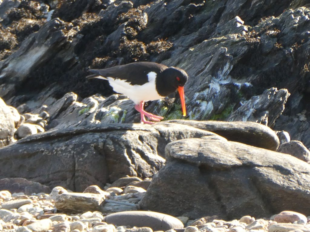
Kintyre’s mixture of coastline, woodland, moorland and relatively sparse population makes it a good place for wildlife spotting. Red deer, seals, otters, buzzards and golden eagles are all found around the peninsula, while the surrounding waters can produce sightings of dolphins and porpoises. The west coast is particularly good for marine wildlife, so it’s worth keeping an eye on the sea when you stop along the more exposed coastal sections.
As always, give wildlife plenty of space and avoid disturbing animals, particularly around nesting or breeding areas.
Ticks
Ticks are common on Kintyre, particularly in long grass, bracken, heather, woodland edges and anywhere deer regularly pass through. They don’t jump or fly; they simply latch on as you brush past vegetation or sit down in the wrong patch of grass. They’re most active from spring through to autumn, although mild weather can extend the season.
Personally, I wouldn’t spend too much time worrying about them. They’re just another part of outdoor travel and a little basic prevention goes a long way. Long socks and lightweight trousers help, and if you find yourself pushing through thigh-high bracken or heather, tuck your trousers into your socks. You might look slightly ridiculous, but you’ll probably be the one around camp that evening who isn’t picking ticks off their legs.
Check yourself regularly while riding and give yourself a proper check once you reach camp, paying particular attention to warm or hidden areas such as behind the knees, around the waistband, groin, armpits, neck and sock line. Carrying a tick-removal tool is well worth it.
If you find one attached, remove it as soon as possible. Use a proper tick-removal tool according to its instructions or fine-tipped tweezers, gripping the tick as close to the skin as possible and pulling steadily upwards without crushing it. Avoid Vaseline, oils or other home remedies. Afterwards, clean the area and keep an eye on it. Lyme disease can cause an expanding circular or oval rash and flu-like symptoms, although a rash doesn’t always appear, so seek medical advice if you begin feeling unwell following a tick bite.
Spotted something wrong or have updated information? Get in touch here


